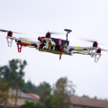
As drones become more and more prevalent, their potential for mapping applications is becoming increasingly apparent. But what exactly are point clouds and how can they be utilized when it comes to drone mapping technologies? In this article, we explore the use of point clouds in drone mapping technologies, and how they can help to create highly accurate 3D models. Point clouds are collections of data points gathered from a variety of sources that can be used to create a 3D representation of a scene. These points are usually gathered by light detection and ranging (LiDAR) sensors, although they can also be gathered using photogrammetry or other methods.
Point clouds contain a wealth of information about the environment, including distances, colors, and textures. By combining this data with other sources, such as aerial photographs, it is possible to create detailed 3D models that can be used for a variety of purposes. The use of point clouds in drone mapping technologies allows for highly accurate measurements and models of the environment. By combining the point cloud data with aerial photographs or other data sources, it is possible to create highly accurate 3D models that can be used for navigation or other mapping applications.
Point clouds can also be used to identify objects in the environment, such as buildings or vegetation, as well as to measure distances between objects or points. This makes them invaluable for a variety of mapping applications. In this article, we explore the use of point clouds in drone mapping technologies and how they can help to create highly accurate 3D models. We will discuss the advantages of using point clouds and how they can be integrated into existing mapping applications.
We will also examine the challenges associated with using point clouds, such as processing large amounts of data and ensuring accuracy. Finally, we will look at some of the innovative ways in which point clouds can be used in drone mapping technologies. Point clouds are made up of millions of points, or data points, that represent the surface of an object or environment. Each point contains three spatial coordinates (x, y, and z) and a color value. This makes it possible to create a 3D representation of an area or object.
In drone mapping, point clouds are used to capture aerial images of specific areas. This data can then be used to generate accurate 3D models, topographic maps, and other visualizations.
Point clouds
provide more detailed information than traditional aerial photography, allowing for greater accuracy in mapping applications. Using point clouds in drone mapping also offers many benefits. For example, they allow for faster processing and higher resolution data than traditional aerial photography.They can also be used to create more detailed 3D models that can be used for various purposes, such as infrastructure planning or construction projects. Another benefit of point clouds is that they can be used to detect changes in terrain over time. This can be useful for assessing the effects of natural disasters or tracking land use changes over time. Additionally, point clouds can be used to detect objects in an environment and can be used for navigation purposes.
Conclusion
Point clouds offer many advantages when it comes to drone mapping technologies. They provide faster processing, higher resolution data, and the ability to create more detailed 3D models.Additionally, they can be used to detect changes in terrain over time and can be used for navigation purposes. In conclusion, point clouds are an important tool in the field of drone mapping technologies, providing users with a wide range of benefits.
How Are Point Clouds Used in Drone Mapping?
Point clouds are used in drone mapping to capture aerial images of specific areas and generate 3D models. This data can then be used for a variety of purposes, such as infrastructure planning and construction projects. Additionally, point clouds can be used to detect objects in an environment and can also be used for navigation purposes.Point clouds are created using sophisticated sensors and provide detailed images of objects and environments that are not visible to the naked eye. This is a highly efficient way of gathering data for aerial mapping projects, as it provides a comprehensive view of the area being mapped.
What Are the Benefits of Using Point Clouds in Drone Mapping?
Point clouds offer several advantages when it comes to drone mapping. These include faster processing and higher resolution data than traditional aerial photography, the ability to create more detailed 3D models, and the ability to detect changes in terrain over time. Using point clouds for drone mapping allows for faster image processing speeds and higher resolution data than traditional methods of aerial photography.This means that images can be captured with more detail and accuracy, leading to a more accurate 3D model. Additionally, point clouds can be used to detect changes in terrain over time, which can be incredibly useful for surveying and monitoring areas that are subject to rapid change. The use of point clouds in drone mapping also allows for the creation of detailed 3D models. The data captured in the point cloud can be used to accurately recreate an area in 3D, allowing for more detailed analysis and a better understanding of the area being mapped.
Overall, point clouds offer many benefits when it comes to drone mapping. Faster processing speeds and higher resolution data enable a more accurate 3D model to be created, while the ability to detect changes in terrain over time can be useful for surveying and monitoring areas. In conclusion, point clouds are a powerful tool for drone mapping technologies. They provide faster processing and higher resolution data than traditional aerial photography, as well as the ability to create more detailed 3D models.
With their many advantages, point clouds are an invaluable asset for drone mapping applications. Point clouds can also be used to monitor changes over time, providing real-time analysis of the environment. This is especially useful for surveying and monitoring changes in terrain or infrastructure. Moreover, point clouds can be used for navigation purposes, allowing drones to navigate safely and accurately through complex environments. All in all, point clouds are an integral part of drone mapping technologies, providing a range of benefits that make them an invaluable asset.


Leave a Comment